Page 1 of 1
Freight Consist on Google Maps

Posted:
Fri Jun 24, 2016 8:19 pmby Robert Brigham
I don't know if anyone else has noticed this, but the current image of the line about a mile SE of Osier shows a freight consist with what looks like 3 cabooses. The citation at the bottom says the imagery is copyright 2016, and the foliage is just starting to turn green. Is this really from this year? Any guesses as to what train this is (it didn't look like any of the Fireman/engineer School consists I saw in any pictures)? Was this a photo special?
Re: Freight Consist on Google Maps

Posted:
Fri Jun 24, 2016 8:24 pmby Pete Dahlberg
It could have been a ferry operation to Antonio for one of charters
Re: Freight Consist on Google Maps

Posted:
Sat Jun 25, 2016 5:28 amby Larry Sullivan
Using Google Earth - which uses the same images as Google maps, it says that the imagery date is from 9/28/13.
Re: Freight Consist on Google Maps

Posted:
Sat Jun 25, 2016 5:33 amby Larry Sullivan
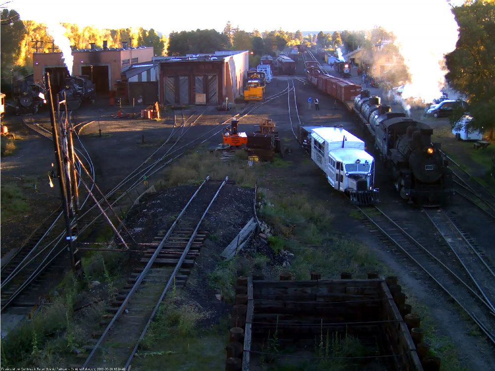
And thanks to Jason and his cam captures, the 2nd image here may indeed be that train.
viewtopic.php?f=79&t=1405 I'm attaching it here as well, this is from 9/28/13 capture by Jason

- 20130928-Chama-315--002.jpg (202.88 KiB) Viewed 6097 times
Re: Freight Consist on Google Maps

Posted:
Sat Jun 25, 2016 4:07 pmby Pete Dahlberg
Given the presence of the Goose, it very well could be a setup for a special or charter. Do we have a means of checking what was happening on that date or several days following?
Re: Freight Consist on Google Maps

Posted:
Sat Jun 25, 2016 7:17 pmby Robert Brigham
Larry and Jason,
That looks like the train alright. Thanks for the sleuthing.